Physical Address
304 North Cardinal St.
Dorchester Center, MA 02124
Physical Address
304 North Cardinal St.
Dorchester Center, MA 02124

Ancient civilizations relied heavily on the stars for navigation, using the night sky as a guide across vast distances. They observed celestial bodies, mapping them meticulously to create reliable systems for travel and exploration. From the Phoenicians sailing the Mediterranean to the Polynesians navigating the Pacific, these civilizations demonstrated remarkable skill in astronomy and seafaring.
Navigators utilized constellations and the movements of planets to orient themselves and determine their positions. They developed techniques that included using the North Star as a constant point in the Northern Hemisphere and recognizing seasonal star patterns that correlated with changes in weather and sea conditions. This deep understanding of the cosmos allowed them to undertake significant voyages, expanding their territories and establishing trade routes.
The legacy of these ancient navigators is evident in modern navigation practices. Techniques pioneered by civilizations such as the Egyptians, Greeks, and Chinese laid foundational knowledge that continues to influence navigation today. By uncovering how they charted the skies, one gains insight into not only their survival but also their adventurous spirit that drove exploration.
Ancient civilizations relied heavily on celestial navigation, using astronomical bodies like stars, the sun, and the moon to guide their journeys. Understanding this practice involves grasping key concepts of the night sky, methods for measuring latitude and longitude, and the development of various navigation instruments.
To navigate effectively, ancient peoples observed the night sky meticulously. They relied on fixed stars, which provided consistent reference points. Constellations played a significant role, serving as guides and helping in storytelling.
Notable constellations included:
The movement of planets was also significant. Unlike stars, they had varied positions, aiding navigators in tracking time and location. The sun’s position during the day further assisted in directional choices.
Determining one’s position on Earth involved measuring latitude and longitude, fundamental to ancient navigation. Latitude, the distance north or south of the equator, was typically calculated using the sun’s height at noon or Polaris’ angle above the horizon.
To find longitude, ancient navigators faced challenges. They often relied on timekeeping methods, noting the sun’s position relative to local time. This method involved complex calculations and could be inaccurate without precise timekeeping devices.
Mathematics was crucial in these calculations. It enabled civilizations to create maps that reflected their understanding of the world.
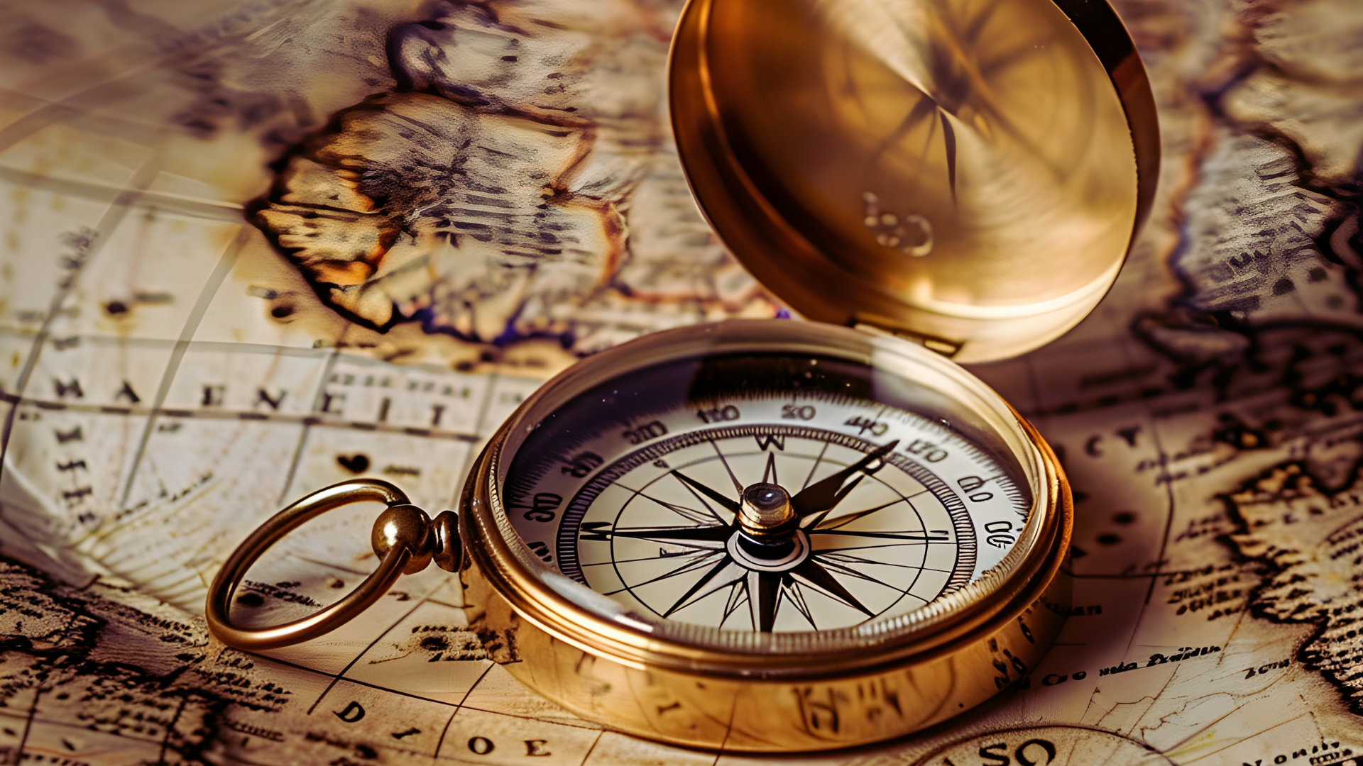
Ancient navigators innovated various tools to enhance their navigation efficiency. The sextant became vital for measuring angles between celestial objects and the horizon, allowing for accurate position plotting.
The star compass helped sailors navigate using stars. It was a simple yet effective tool for distinguishing between different celestial bodies.
As knowledge advanced, techniques evolved. Though lacking the sophistication of modern global positioning systems (GPS), these early tools laid the groundwork for future navigation methods. Each innovation contributed significantly to enhancing navigational accuracy and safety on long voyages.
Ancient civilizations relied profoundly on celestial bodies for navigation, orientation, and timekeeping. By observing the stars, they developed methods to guide them across vast oceans and deserts, as well as to plan agricultural activities.
Polaris, known as the North Star, served as a crucial navigation tool for ancient travelers. Its position in the northern sky makes it a reliable point of reference. For navigators in the Northern Hemisphere, Polaris remains almost fixed, lying directly above the North Pole.
Ancient mariners used the North Star to determine their latitude by measuring its angle above the horizon. This consistently reliable indicator helped sailors avoid dangerous waters. A star compass, utilizing the North Star’s position, allowed accurate guidance throughout the night, facilitating trade and exploration.
Constellations played a significant role in early navigation techniques. Ancient cultures, including the Polynesians and Greeks, recognized specific patterns among the stars. These arrangements helped voyagers identify directions and seasons.
Sailors often memorized important constellations visible during different times of the year. For instance, the position of Orion signaled the best time for harvesting in certain cultures. Such knowledge was essential for timely voyages, ensuring travelers could return safely home after long journeys.
The Sun and Moon were vital celestial bodies for navigation. Ancient navigators utilized their positions to determine cardinal directions during the day and night. The Sun’s path across the sky provided clues to east and west, while the Moon’s phases assisted in night navigation.
Solar eclipses and lunar cycles were also meaningful events for timekeeping. These occurrences were often recorded in calendars, helping societies plan agricultural activities and ceremonial events in relation to the celestial movements.
Calendars in ancient civilizations were closely tied to astronomical events. They relied on specific celestial alignments to mark important dates. For example, the heliacal rising of Sirius indicated the start of the Nile’s flooding season for Egyptian farmers.
Many cultures developed intricate systems for tracking time based on the positions of the stars, the Sun, and the Moon. This included establishing harvest calendars that coincided with seasonal changes. Such methods were critical for maximizing agricultural productivity and ensuring food security.
The relationship between ancient civilizations and the stars reflects a deep cultural significance tied to navigation methods. Different societies developed unique astronomical techniques that guided exploration, trade, and even agricultural cycles.
The ancient Egyptians closely observed the stars, particularly Sirius, which signaled the annual flooding of the Nile. They aligned their pyramids and temples to celestial bodies, using them as tools for navigation and temporal tracking.
Sirius’s heliacal rising marked the start of their new year, linking astronomy to their agricultural calendar. The Great Pyramid of Giza features precise alignments, suggesting that stellar navigation played a pivotal role in its architectural design and spiritual beliefs.
In ancient Greece, astronomers like Aristarchus of Samos made strides in understanding the cosmos. They developed theories about the heliocentric model, which placed the sun at the center of the universe, contrasting with the geocentric model advocated by Aristotle and Ptolemy.
The Greeks utilized stars for navigation as well, creating star charts that mariners relied on for maritime travel. Additionally, mathematicians such as Pythagoras contributed to the mathematical foundations of astronomy, enhancing navigation techniques and celestial mapping.
Babylonian civilization made significant contributions to astronomy and mathematics, establishing one of the earliest known star catalogs. They meticulously recorded celestial events, which helped in creating calendars and improved navigation methods.
Their ability to predict lunar eclipses and planetary movements was remarkable. They developed linear and cylindrical models of the sky that aided in navigation, influencing subsequent cultures in their quests for precision in celestial navigation.
Polynesian navigators employed advanced techniques to traverse vast oceanic distances long before modern instruments existed. They relied on the stars, ocean swells, and wind patterns for navigation, with star maps memorized by experienced mariners.
The Polynesians identified specific stars that remained constant during voyages. Their knowledge of the night sky allowed them to confidently navigate between islands, illustrating a profound relationship between their seafaring culture and the cosmos.
Ancient civilizations laid the groundwork for navigation techniques still in use today. Their understanding of the stars and celestial bodies has influenced both scientific advancements and modern navigational tools.
The necessity of celestial navigation drove significant progress in both science and mathematics. Ancient cultures developed sophisticated methods to track celestial bodies.
Ptolemy’s work helped map the stars, guiding explorers and informing later scientific inquiry. The concepts from these early works still resonate in contemporary astronomical studies.
The transition from simple instruments to advanced navigation systems illustrates the lasting impact of ancient techniques. Early navigators utilized tools like the star compass and sextant to determine their position at sea.
Modern technology, such as GPS, is still rooted in celestial navigation principles. While contemporary systems may not rely on stars directly, the foundational concepts remain integral to navigation today. The evolution from ancient practices to today’s technologies shows the enduring significance of celestial navigation.